Coordinates: 46°27’41″ N 8°13’40″ E 1360m ASL
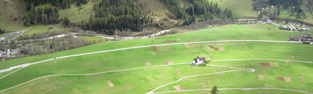
This is a large, straightforward and frequently used landing field, half-way along the Goms. It’s very easy to identify from the air from a considerable distance in both directions, as there’s a small church right in the middle of the valley there, with no other buildings nearby. The Münster sailplane runway airspace is located 1km to the east, which you should take care to avoid if approaching from that direction. There are no side valleys nearby, so it’s generally a safe option even in adverse conditions.
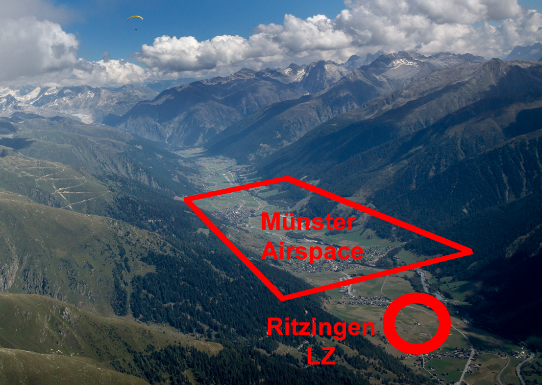
Ritzingen landing field and Münster airspace
In the morning, it’s likely that the breeze at ground level here will be light and variable, probably pulled towards the sunny side of the valley by thermals, but as the day progresses, it’s likely to start blowing from the east and to increase in strength. It often exceeds 30 km/hr in mid-afternoon, particularly in north overpressure, but is nearly always laminar. There is a windsock about 100m east of the church, by which most pilots land, but if the grass is long there and you can see a nearby area where it’s short, that would be preferable from the farmer’s point of view. You should pack up beside the tarmac track leading to the church.

Ritzingen landing field, viewed from the north
Very occasionally, you can encounter convergence between the usually dominant Grimseler and the south-westerly breeze from Brig here. This can produce tricky landing conditions as the wind switches around, but also the opportunity for a low save. Keep an eye on any flags in the general area, which may be pointing in varying directions if this is happening. If you identify this situation with plenty of height, or can use the convergence to gain enough altitude, heading to Niederwald around 4km to the west is likely to be your best option (and there are plenty of bomb-out fields on the way if you don’t make it).
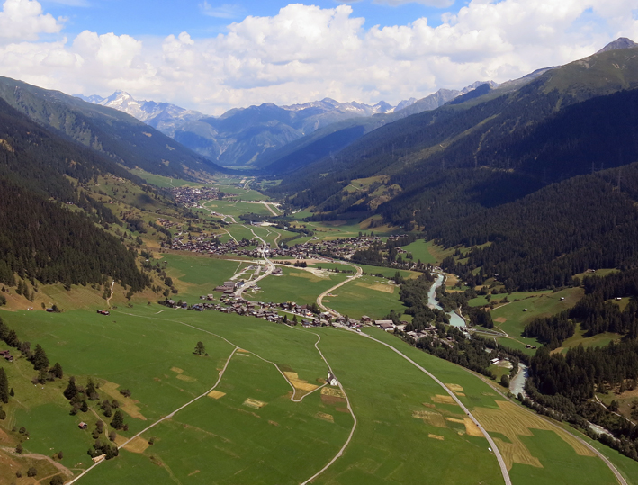
Approaching Ritzingen landing field from the west
Once you have packed up, the nearest train station is Gluringen, to the east, not Biel, to the west.